
Tool fulfills a need not addressed by other gridlock assistants
By Ann-Christine Diaz
Agency The Community, based in Miami, wants to help relieve some of the commuting troubles specific to its city—those associated with bridge traffic. The city’s downtown is home to three major drawbridges that cross the Miami River, a huge source of gridlock in the area. So the shop devised an app that alerts commuters to real-time jams related to bridge activity.
According to app co-creator and The Community’s Creative Director Raphael Franzini, the “Bridge Forecast” app was inspired by a hole in the offerings of other traffic assistants like Waze and Google Maps, which don’t accurately predict delays caused by drawbridges. “When a drawbridge goes up, they adjust in that moment and it is already too late for drivers to alter their route,” he says. “We witnessed this problem first hand and decided to create a unique system that can benefit commuters along rivers directly affected by drawbridge traffic.”
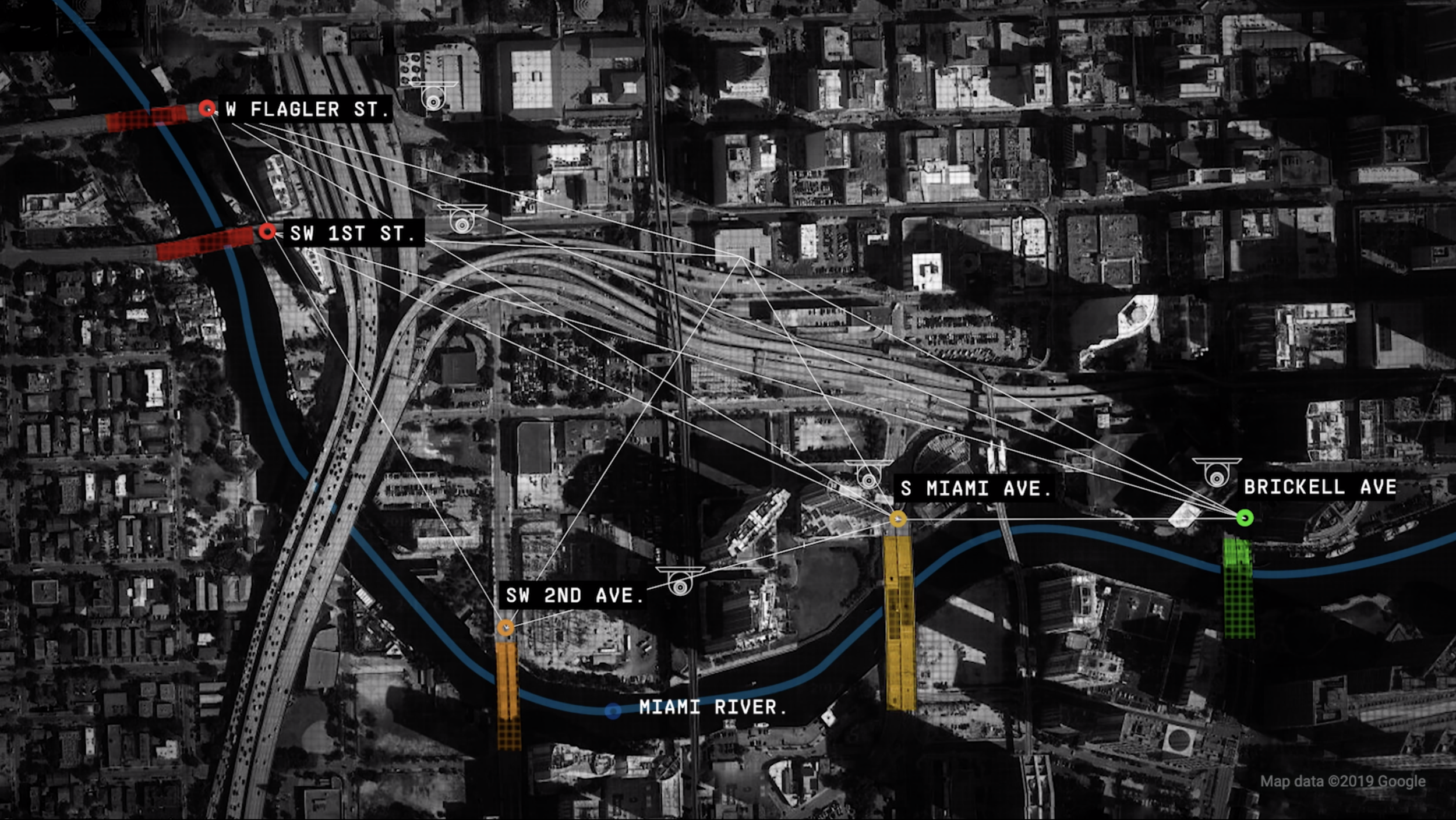
Fellow app creator Chris Neff, The Community’s senior director of innovation, says the agency used a computer vision model and loads of data from Nest cameras placed throughout the city to develop the app. Round-the-clock cameras were placed overlooking the major drawbridges at Miami Ave., Southwest 2nd Ave., and Brickell Ave.
“We studied the bridges for months to draw conclusions and understand patterns within the data,” he says. The agency then applied machine learning to that data in order to predict a five-minute window around when the bridges would go up. Those findings were then applied to a simple interface that provided real-time bridge updates.
During development, Neff says that the biggest hurdle was ascertaining the best buildings from which to place cameras capturing the bridge data. “Early on we knew the weather would be a factor affecting the clarity of our cameras, but we then had to deal with cleaning and maintenance to the buildings that impacted some of our views,” he says. “This caused us to explore more stable locations and redundancies. All of these obstacles helped forge the strong integrity of our system to date.”
The agency's ultimate goal is to alleviate the city's traffic, period, so it’s opened up the app’s API for other developers to use.
Neff says that the app, which debuted in April, is currently working at 91 percent accuracy within a five-minute window. Franzini says that it’s already helped influence the accuracy of local radio and TV traffic reports.
The agency is now trying to expand the app’s coverage to other bridges on the river and develop its capabilities even further. “We aren’t shy about this being the foundation and not the end all be all,” Neff says. “We hope to scale this, add new forms of detection to our predictive model, and replicate this in other cities.”